Quantcast
Channel: RIDGELINEIMAGES.com
Viewing all 347 articles
Browse latest View live

10 Interesting Facts about Mount Fuji

$
0
0
Ten Interesting Facts about Mount Fuji 2015

Mount Fuji Facts, Figures and Musings

Famed for its elegant symmetrical cone, Mount Fuji is actually an active stratovolcano last erupting in December 1707. First climbed by a monk in 663, the sacred mountain is beset upon by an annual pilgrimage to climb its peak during the short two and a half month climbing season. Visitor numbers have spiralled over the years and more so recently since its official inclusion as a UNESCO World Cultural Heritage Site in 2013. The volcano straddles Yamanashi and Shizuoka prefectures which means plenty of buck passing about how to deal with the accumulated garbage and effectively manage the fragile mountain ecosystem. I had the good fortunate to climb Mount Fuji back in 2000 and hope the following run-down provides some new insights around this majestic mountain.
.

# 1. Buddhist monk christens Kyoto as the 19th Prefecture.

Mt. Fuji fact6

# 2. Starting back in 2005, steps were taken to clean up the mountain.

Mt. Fuji fact5

# 3. Training playground for the hardiest of climbers.

Mt. Fuji fact9

# 4. A short window of opportunity.

Mt. Fuji fact10

# 5. Not for the geographically challenged.

Mt. Fuji fact1

# 6. Ensure to bring plenty of fluid to hydrate.

Mt. Fuji fact2

# 7. A long shot of visibility prevails.

Mt. Fuji fact3

# 8. The Meiji restoration lifts the ban.

Mt. Fuji fact8

# 9. Best enjoyed in the company of thousands.

Mt. Fuji fact4

# 10. Attempts to stem the tide through punitive fees.

Mt. Fuji fact7

The post 10 Interesting Facts about Mount Fuji appeared first on Ridgeline Images.


Wild Camping: 15 Essential Tips

$
0
0
Wild Camping 15 Essential Tips

How to Fully Embrace a Wild Camping Experience

The basic essence of wild camping entails seeking out wilderness experiences away from official campgrounds. While actual ‘hiding’ isn’t usually necessary unlike stealth or guerrilla camping that tend to be undertaken in more urban environments, it is still important to keep a relatively low profile. Different countries, states and territories all have their own rules and regulations when it comes to wild camping in National Parks and Forest Service lands so check with the relevant land agency to be safe.

The other crucial element is being respectful towards nature. Most of these remote campsites we seek out are not marked on maps, have never been camped on before and as such need to be treated with due care and respect. I guess the first and foremost rule of wild camping is always leaving your site as pristine as you found it.

  1. Pick a nice spot

Key to enjoying a wild camping experience is knowing where to pitch. Ideally find somewhere flat and dry, preferably 30 minutes from designated campsites. Don’t pitch your tent right away instead scout for suitable sites that provide protection from the wind, away from cold air pockets and be mindful of widowmakers in enclosed areas.

  2. Speak with people

Even if you’re familiar with the area, there’s nothing wrong with asking for a little friendly advice as to where might be a better spot to camp. Most folk are usually in the same situation and are happy to offer some insights.

  3. Find a water source

Not vital but camping close to a water hole is convenient and means you won’t have to go rummaging for one later.

  4. Camouflage

Run with a green or earth toned tent to better fit with the surroundings such as a MSR. For further concealment and lightweight versatility consider sleeping with a standalone mattress and bivvy sack.

  5. Consider flooded rivers

Stay well clear of dry riverbeds no matter how tempting they may appear and camp up high after negotiating any rivers you may need to cross.

  6. Arrive late and depart early

Whilst you don’t want to be setting up camp in the dark you want to ensure its late enough in the day that most hikers have moved on. Likewise don’t linger around in the morning waiting to be disturbed.

  7. Respect the peace

In the instance your covert location is stumbled upon you may very well find yourself being asked to move on. Things happens, rather than argue the point find another site further away from potential trouble. Don’t trespass or camp on private property without special permission.

  8. Don’t tempt the wildlife

Consider cooking some distance away from the intended campsite especially in bear country where you should cook at least 200 metres away from your tent. Hang your food if you suspect animals in the area.

  9. No campfires

Unless absolutely necessary its best not to light a campfire, as apart from leaving a scar on the landscape you risk burning down your tent or worse. Carry a lightweight stove for cooking.

  10. Leave your music at home

In a similar vain to lighting campfires, don’t play music or do anything else which is likely to draw attention to yourself or potentially annoy those around you.

  11. Use your headlamp sparingly

During the evening avoid using your headlamp for long periods as it may reveal your whereabouts if you’re wishing to maintain a low profile.

  12. Pay heed to your bathroom

For your morning ablutions maintain at least 50 – 100 metres away from water sources, trails and your campsite. Use a trowel to dig at least a 6 inch deep hole and fill it in sufficiently before leaving.

  13. Navigation and signalling device

In situations where you might find yourself sick or injured ensure you carry a fully charged phone, GPS, whistle, mirror or signalling flare to attract attention.

  14. Leave no trace

Goes without saying but ideally you want to leave your wild camping site as pristine as you found it. Replace stones and logs as you found them. Before heading out double check to make sure no rubbish or food scraps are left behind.

  15. Tell someone

Like any backcountry outing play the safety card first, ensure a map and itinerary is left with a family member or friend.

On a final note

Last of all embrace the unique freedom that comes with wild camping, the chance to camp in little explored spots is one of the wonderful things about backcountry exploration. The more you do it, the more self-reliance you will build, allowing you to relax and enjoy those moments spent outdoors.

.
.

The post Wild Camping: 15 Essential Tips appeared first on Ridgeline Images.

Mount Takao Plum Blossom Festival

$
0
0
Mount Takao Plum Blossom Festival 2015

The Arrival of Spring Heralds in Plum Blossoms

In past years I have been somewhat reluctant venturing into areas invested with sugi (a Japanese conifer) at this time of year with a predisposition towards lengthy sneezing bouts. But decided to risk my health anyway to take in the some of the 10,000 plum trees in the Baigo area of Mt. Takao coming into bloom. The crimson and white plum trees are scattered along a 5 km section of the old Koshu Kaido and while the flowers pay witness to a considerable crowd of day trippers it never feels overly congested. Along the river I ran into some local naturalists photographing the tiny perennial flower hana neko-no-me Chrysosplenium with it’s apparent resemblence to cats eyes. Several food stalls grace the promenade allowing the weary to partake in a quiet ale while listening to the soothing tones of the Japanese koto. The 90 minute walking course commences from the north exit of Takao Station meandering along the Kobotoke River past the Takaotenmangu and finishing at the Kobotoke Bairin bus stop.

Access: From the Kobotoke Bairin bus stop take a 15 minute bus ride to Takao Station (220 yen).
.
Japanese plum blossom Pink plum blossoms White plum blossoms Hana nekonome Chrysosplenium albumem var. stamineum Plum blossoms blooming Plum blossom with  five petals Fishing pond Kobotoke River Japanese cornel Cornus officinalis Obligatory yakisoba stand
.


The post Mount Takao Plum Blossom Festival appeared first on Ridgeline Images.

The Sagamiko Illumination Forest

$
0
0
The Sagamiko Illumination Forest

Largest Illumination Event in the Greater Tokyo Area

A short one hour train ride from downtown Tokyo ushers you to the largest illumination spectacle in the Kanto area, the Sagamiko Illumillion.

Illumination events in Japan are immensely popular with Tokyo alone host to a total of 23 large scale illuminations this year. The most admired include the Omotesando Illumination with its striking champagne coloured LEDs and the Tokyo Dome city winter illumination that boasts over 2.2 million lights. In contrast the Sagamiko Illumillion in Kanagawa Prefecture leaves the rest for dead with more than 5 million decorative LED lights draining the local power grid.

Located at the curiously named ‘Sagamiko Resort Pleasure Forest’ the event is now in its seventh year running. While the opening day attracted over a thousand visitors it’s rather secluded location west of Mount Takao means it only receives a relatively small splattering of visitors.

The largest attraction in the park is the Palace of Light an animated light and water show synchronized to classical music. The light displays are divided into themes such as “Sea of Light”, “Light of the Zoo” and “Light of the Flower Garden”. Along with amusement park rides, for an additional 400 yen fee a chair lift whisks passengers up to a mountain overlooking the complex. While most visitors arrive by car it’s also accessible by a local bus service from Sagamiko Station.

Access: From Sagamiko Station (JR Chuo Main Line) take a 8 minute bus ride. Entry fee: Adults 600 yen / children 400 yen. November 1st – April 12th, 2015 – Friday, Saturday, Sunday and public holidays 17:00 until 21:30.
.
Sagamiko illumillion Sagamiko illumillion 02 Sagamiko illumillion 03 Sagamiko illumillion 04 Sagamiko illumillion 05 Sagamiko illumillion 06 Sagamiko illumillion 07 Sagamiko illumillion 08
.


The post The Sagamiko Illumination Forest appeared first on Ridgeline Images.

50 Kanto High Peaks and Counting…

$
0
0
Kanto area hikes

A Guide to Mountains in the Kanto Region

The Kanto Region which includes Gunma, Tochigi, Ibaraki, Saitama, Tokyo, Chiba, and Kanagawa contains many of the most popular hiking trails in Japan. Whilst the following list is a work in progress, it aims to provide a summary of recommended mountains to hike around Kanto. Please check back for future posts.

Name of Mountain (Highest – Lowest) Elevation (metres) Difficulty 1 – 7 (1 least difficult) Length of Hike Typical Hike Time PHOTO
Mt. Akadake 赤岳 2899 m 6 25 km 3 days Yatsugatake hike
Yokodake 横岳 2829 m 6 25 km 3 days Yokodake summit
Mt. Ioudake 硫黄岳 2760 m 6 25 km 3 days Mt. Ioudake summit
Mt. Kinpu 金峰山 2595 m 6 26 km 3 days Mt. Kinpu hike
Mt. Kokushigatake 国師ヶ岳 2591 m 6 26 km 3 days Mt. Kokushigatake summit
Mt. Kobushi 甲武信ヶ岳 2475 m 6 26 km 3 days Summit Mt. Kobushi in mist
Mt. Tokusa 木賊山 2468 m 6 26 km 3 days Mt. Tokusa
Mt. Mizugaki 瑞牆山 2230 m 4 7 km 5.5 hours Jutted peaks of Mt. Mizugaki
Mt. Suisyoyama 水晶山 2158 m 5 24 km 3 days Mt. Suisyoyama summit
Mt. Koreisan 古礼山 2112 m 5 24 km 3 days Mt. Koreisan summit
Karisaka Toge 雁坂峠 2082 m 5 24 km 3 days Karisaka Toge towards Mt. Karisakarei
Mt. Obora 大洞山 2069 m 7 35.5 km 3 days Mt. Obora hike
Mt. Daibosatsu 大菩薩嶺 2056 m 4 23 km 2 days Summit Mt. Daibosatsurei
Mt. Kentoku 乾徳山 2031 m 5 11 km 2 days Mt. Kentoku
Mt. Kumotori 雲取山 2017 m 6 31 km 2 days Mt. Kumotori hike
Daibosatsu-toge 大菩薩峠 1897 m 4 23 km 2 days Daibosatsu-toge
Mt. Okuratakamaru 大蔵高丸 1781 m 4 16.2 km 2 days Mt. Okuratakamaru hike
Mt. Maeshiraiwayama 前白岩山 1776 m 6 31 km 2 days Mt. Maeshiraiwayama summit
Mt. Nanatsuishiyama 七ッ石山 1757 m 6 31 km 2 days Mt. Nanatsuishiyama
Mt. Hamaiba ハマイバ丸 1752 m 4 16.2 km 2 days Mt. Hamaiba
Mt. Takanosu 鷹ノ巣山 1736 m 4 14 km 2 days Mt. Takanosu hike
Mt. Ryokami 両神山 1723 m 5 12 km 7 hours Mt. Ryokami
Mt. Hirugatake 蛭ヶ岳 1673 m 5 23 km 2 days Mt. Hirugatake summit
Mt. Tanzawa 丹沢山 1567 m 5 23 km 2 days At last Mt. Tanzawa
Mt. Mito 三頭山 1531 m 4 8.5 km 5 hours Mt. Mito hike
Kirimogamine 霧藻ヶ峰 1523 m 6 31 km 2 days Mt. Kirimogamine summit
Mt. Tounotake 塔ノ岳 1491 m 5 23 km 2 days Summit Mt. Tounotake
Mt. Kayanoki 榧ノ木山 1485 m 4 14 km 2 days Larches near Mt. Kayanoki
Mt. Gozenyama 御前山 1405 m 3 10 km 5 hours Mt. Gozenyama hike
Mt. Douman 道満山 1314 m 5 11 km 2 days Mt. Douman
Mt. Buko 武甲山 1304 m 4 15.5 km 6 hours Mt. Buko hike
Mt. Odake 大岳山 1266 m 3 10.5 km 5.5 hours Mt. Odake hike
Mt. Oyama 大山 1252 m 3 7.5 km 4 hours Mt. Oyama hike
Mt. Honita 本仁田山 1224 m 3 9.4 km 5 hours Mt. Honita summit
Mt. Kasamaruyama 笠丸山 1189 m 2 4.5 km 4 hours Small shrine Mt. Kasamaruyama
Mt. Kurato 倉戸山 1189 m 4 14 km 2 days Mt. Kurato summit
Mt. Nukazasu ヌカザス山 1175 m 4 8.5 km 5 hours Mt. Nukazasu
Mt. Ougiyama 扇山 1138 m 4 13.5 km 6 hours Mt. Ougiyama hike
Mt. Momokurasan 百蔵山 1003 m 4 13.5 km 6 hours Mt. Momokurasan summit
Mt. Iyo イヨ山 979 m 4 8.5 km 5 hours Mt. Iyo
Mt. Bonooreyama 棒ノ峰山 969 m 5 12 km 6 hours Ridge hopping to Mt. Bonooreyama
Mt. Makinooyama 槙ノ尾山 945 m 5 12 km 6 hours Mt. Makinooyama summit
Mt. Sengenrei 浅間嶺 903 m 2 8 km 4 hours Mt. Sengenrei hike
Mt. Hinodeyama 日の出山 902 m 4 16 km 6 hours Tokyo hikes Mt. Hinodeyama
Mt. Jinba 陣馬山 857 m 3 11 km 4 hours Mt. Jinba hike
Mt. Kuroyama 黒山 842 m 4 13 km 6 hours Mt. Kuroyama hike
Mt. Iwatakeishiyama 岩茸石山 793 m 3 10.5 km 4.5 hours Mt. Iwatakeishiyama
Takamizusan 高水山 759 m 3 10.5 km 4.5 hours Takamizusan temple entrance
Mt. Kobotoke-Shiroyama 小仏城山 670 m 1 10 km 4 hours Mt. Takao hike
Mt. Mitsumuroyama 三室山 646 m 3 10.5 km 5 hours Hinodeyamakita Ridge hike
Mt. Takao 高尾山 599 m 1 10 km 4 hours Mt. Takao summit
Mt. Kompirayama 金比羅山 468 m 3 11 km 4 hours Mt. Kompirayama marker
Mt. Nokogiri 鋸山 329 m 1 4 km 3.5 hours Mt. Nokogiri summit
Mt. Koubou 弘法山 235 m 1 7 km 2.5 hours Mt. Koubou hike

The post 50 Kanto High Peaks and Counting… appeared first on Ridgeline Images.

Mt. Koubou 弘法山

$
0
0
Mt. Koubou hike

Mt. Gongen 権現山 – Mt. Koubou 弘法山

Duration: 2.5 hours
Distance: 7km
Difficulty: easy
Usage/Traffic: heavy
Start: Hadano Station (Odakyu Odawara Line)
Finish: Tsurumaki-Onsen Station (Odakyu Odawara Line)
Maps: Shobunsha’s Yama-to-Kogen 山と高原地図 series 1:50,000 [No.28 Tanzawa 丹沢]


.

Family Oriented Hike in the Mount Oyama Foothills

Located in the foothills south of Mount Oyama this family oriented hike is only an hour train ride from Shinjuku Station on the Odakyu Odawara Line. The hike is enormously popular year round especially during the cherry blossom season where lanterns light up the flowers in the early evening.

From Hadano Station turn right and walk along the road for about 20 minutes where the trail head commences on your right just a little way up from the 7-Eleven. The 150 metre climb up to Mt. Gongen 権現山 (245m) isn’t particularly steep and remains on a rolling ridge passing Mt. Koubou 弘法山 (235m) 15 minutes further along. There are plenty of picnic tables and benches to take lunch and clear days affords views towards Mt. Fuji and Sagami Bay. For those looking for an alternative route to Mt. Oyama, half way along finds a 9 km route snaking its way to the summit. After passing Mt. Azuma 吾妻山 the trail heads down to the Tsurumaki-Onsen Station where you can relax in its namesake hot spring (1,000 yen).
.
Trail head to Mt. Koubou Lanterns shadow the trail View from Mt. Koubou View towards Mt. Oyama Remnant petals lay

The post Mt. Koubou 弘法山 appeared first on Ridgeline Images.

Mt. Obora 大洞山

$
0
0
Mt. Obora hike

Shougen Toge 将監峠 – Mt. Obora 大洞山 – Sanjounoyu 三条の湯

Duration: 3 days
Distance: 35.5km
Difficulty: hard
Usage/Traffic: moderate
Start: Ochiai Bus Stop
Finish: Omatsuri Bus Stop
Maps: Shobunsha’s Yama-to-Kogen 山と高原地図 series 1:50,000 [No.25 Kumotori-san Ryokami-san 雲取山・両神山]


.

Golden Week Hikers on Mass

While Golden Week in Japan tends to correspond with some of year’s best weather the downside of course is battling it out with an inordinate number of climbers. Having said that this hike includes plenty of remote and secluded trails allowing for a true wilderness experience.

Day 1: Drawn-out Slog to the Trail Head (13.5km)

Getting to the trail head is lengthy enterprise taking 6.5 hours from where I live in western Tokyo. On weekends and public holidays there are two daily bus services from Enzan Station to Ochiai 落合 the closest transport link. The morning bus departs at 08:30 outside the south exit and not surprisingly there was a large contingent of hikers lined up though mercifully, most were headed to the Nishizawa Gorge. By the time the cramped hour bus ride was up only four of us disembarked at Ochiai as most hikers shrewdly park nearby the trail head.

From the bus stop continue walking 100 metres turning left at a road which follows the Takahashigawa River. After 25 minutes turn right past a small shrine which heads up to a gate near the Atarashi Inugiritoge 新犬切峠. Following this road takes you to the Sakuba Hirahashi 作場平橋 car park with restroom facilities. From here thankfully it’s only another 45 minutes of dreary road side walking to the trail head. The trail up to the Shougen Yamagoya 将監小屋 is easy-going following a vehicular access route. Total walking time from the trail head should take a little over 2 hours with a couple of small watering holes available to fill up if needed.

What I wasn’t prepared for was the number hikers who had already made camp by the early afternoon. Best advice is to select a spot on one of the embankment edges to avoid being hemmed in and to provide a little space to manoeuvre while cooking. The evening was greeted with a full moon and remarkably for this time of year the temperature barely dipped below 10 degrees overnight.

Day 2: A Precipitous Valley Descent Almost Comes Unstuck (12km)

Most folk had eaten breakfast and packed up well before I exited the tent at a more leisurely 06:00am, largely I suspect to secure a site at the next campsite. From the Shougen Yamagoya it’s worth wandering up to the Shougen Toge which along with providing a bird’s-eye view over the hut also has a nice outlook towards Rino Toge リンの峰. The trail from the Shougen Toge across to Hageiwa Rock 禿岩 is easily the most picturesque with occasional clear vistas towards Mount Fuji and the Minami Alps. The rock outcrop itself provides a wonderful view over the Chichibu Tama Kai National Park. Just below the rock crop finds a prominent trail junction with an option of taking a short detour up to Mt. Obora 大洞山 (2,069m).

The next section down to the Sanjounoyu Yamagoya 三条の湯 looked all fine and dandy when I planned out the hike but in reality was far from it. The first sign I thought something was amiss was passing a lone climber sporting a helmet, his face was solemn, even grim. A little further along I realized why. The trail between the two watering holes leaves little margin for error with some sections no more than a foot wide, with its edges skating into an inextricable abyss below. According to the staff at the Yamagoya during the spring the south-easterly ridges become dry, erode and hence become somewhat unstable. Having passed this far there was no chance of turning back and could only hope things would improve, which they did but only slightly. Arriving at the campsite feeling exhausted and mentally spent I quickly spied a nice spot, set up the tent and prepared for an afternoon relaxing by the river.

Day 3: Another Long Forestry Road Awaits (10km)

The campsite filled to overcapacity with 70 odd tents miserably cramped into the 20 designated spaces, though the quiet hum of the river muted any extraneous noise. From the Sanjounoyu Yamagoya the trail lives a high and mighty existence as it shadows alongside the Ushiroyama River. While the trail is narrow it makes a pleasant contrast to the previous day’s angst and takes around 30 minutes to reach the Ushiroyama Road. This graded forestry road shifts between concrete and gravel with few nice areas to rest until reaching the main gate. I seemed to make good headway and found myself resting on a grassy road embankment above the Omatsuri Bus Stop a good 90 minutes before the next bus back to Okutama Station.
.
Spring weather at its finest White cherry blossom Fine view from Atarashi Inugiritoge Trail head to Shougen Toge Packed to the gills Shougen campsite Shougen Yamagoya Full moon Shougen Yamagoya Looking down towards Shougen Yamagoya Shougen Toge Minami Alps from Hageishi Rock Sanjounoyu Yamagoya Another packed campsite at Sanjounoyu Drenched tent Sanjounoyu campsite Waterfall along road to Omatsuri Road heading down to Omatsuri

The post Mt. Obora 大洞山 appeared first on Ridgeline Images.

Mt. Kentoku 乾徳山

$
0
0
Mt. Kentoku hike

Kougen Hut 高原ヒュッテ – Mt. Kentoku 乾徳山 – Mt. Douman 道満山

Duration: 2 days
Distance: 11 km
Difficulty: moderate
Usage/Traffic: moderate
Start: Kentokuyama Tozanguchi Bus Stop
Finish: Kentokuyama Tozanguchi Bus Stop
Maps: Shobunsha’s Yama-to-Kogen 山と高原地図 series 1:50,000 [No.26 Kinpu-san 金峰山 Kobushi 甲武信]


.

Spectacular 360-degree Panorama from Mount Kentoku

If there was ever a mountain sorely overlooked in Kyuya Fukada’s famous Japanese mountain list its Mount Kentoku as it includes some of the best mountain climbing near Tokyo. This hike is usually undertaken as a day trip from Tokyo though spending an evening at the lovely Kougen Hut plateau is also a worthwhile option.

Day 1: Gradual Ascent to an Attractive Alpine Plateau (3.6 km)

This hike like several others documented on this site starts out from Enzan Station on the Chuo Main Line around 90 minutes by express train from Shinjuku Station or 2.5 hours by local. On weekends and public holidays from April through November there is an infrequent bus service which makes a stop at the Kentokuyama Tozanguchi on its way to the Nishizawa Gorge. During weekdays and at other times you will need your own vehicle or take a 20 minute taxi ride.

The previous evening a sizeable thunderstorm passed through the Kanto region which did a good job at blowing away the haze and delivered two days of clear skies in its wake. The friendly taxi driver at Enzan Station quickly whisked me to the trail entrance in seemingly record time while proudly pointing out some of the loftier nearby peaks. The taxi drops you off at the carpark just above the bus stop. While two trails lead up to the Kougen Hut 高原ヒュッテ it’s recommended to track in a clockwise direction flanking the Tokuwagawa River up the main trail and returning via the Douman Ridge 道満尾根 which is steeper.

Walking along the road for around 20 minutes brings you to the trail entrance proper and so begins a two hour hike to the Kougen Hut. Whilst not particular steep, it certainly gets the blood pumping if you intend on carrying all your gear. Along the route there are two reliable water holes to fill up, with the later one a five minute walk from the unofficial Kougen Hut campsite.

Upon arrival, the plateau was pretty much deserted with presumably most hikers already making their way around the course. The campsite is set gracefully amongst groves of Japanese white birch and there is no shortage of wildlife including plenty of curious Japanese sika deer and even managed to spot a Japanese marten. While camping spots are not marked out, the large open area provides plenty of options for setting up a tent. Otherwise if you decide not to bring your tent, the unsupervised Kougen Hut underwent a substantial renovation last autumn with sleeping space for 10-15 persons and includes an adjacent public restroom.

Day 2: Steep Rock Ledge Wall not for the Faint Hearted (7.4 km)

Like the first day the morning was greeted with blue skies and only the slightest breeze. The hike begins with a short walk up to Oogihira another open plateau a few hundred meters above the campsite and provides the first of several excellent views of Mount Fuji and the Minami Alps. From Oogihira the trail enters into a wooded area where the real scramble for the summit begins. Here you will need to negotiate a series of ladders and chains with one section of chain half way up forcing you outside your comfort zone as you clamber precariously over an exposed rock ledge. Just before the summit is a sheer rock precipice which can be tackled via a long chain or alternatively this wall can sidestepped by taking an easier route to the summit on your right.

On clear days the craggy summit of Mt. Kentoku (2,031m) delivers superb 360-degree views including the jutted Mount Kinpu bluff. Options from the summit include heading back the same route or sweeping around the rear side of the mountain using a lesser ventured through steeper trail. I decided to play it safe and returned the same way to collect my belongings at the campsite. The route via the Douman Ridge trail over Mt. Douman 道満山 (1,314m) back to the bus stop takes around 90 minutes.
.
Kentoku Shrine Mt. Kentoku tozanguchi First water hole Second water hole near campsite Mt. Kentoku from Kougen Hut Clear skies Kougen Hut campsite Recently rebuilt Kougen Hut Herd of Japanese sika deer Japanese white birch Betula platyphylla var. japonica Fanta bottles circa 1975 Sika deer Access road to Kougen Hut Blue skies through green canopy Sign post Kougen Hut Looking up to Oogihira View back to Mt. Fuji Tsukimi moon viewing rock Waterfall rock First chain climb Two chain options here Last chain climb not for the faint hearted Great view of the Minami Alps View towards Mt. Kinpu Mt. Kentoku Mt. Kentoku summit Mt. Douman

The post Mt. Kentoku 乾徳山 appeared first on Ridgeline Images.


Okuchichibu Mountains Western Tokyo

$
0
0
Okuchichibu Mountains

Wilderness at Tokyo’s Doorstep

Situated within the Chichibu Tama Kai National Park in the western part of Tokyo, the Okuchichibu Mountains are a hiker’s paradise allowing us city dwelling folk to escape the confines of the nearby metropolis. The mountains comprise five peaks included in the 100 Famous Japanese Mountains including the striking Mount Kinpu the second highest of the Okuchichibu Mountains. The following ten peaks and mountain passes hope to provide a quick snapshot of this remarkable wilderness area.

# 1. Mount Kinpu 2,599 m (Yamanashi / Nagano Prefecture)

Okuchichibu Mountains Mt. Kinpu
.

# 2. Mount Kumotori 2,017 m (Tokyo Prefecture)

Okuchichibu Mountains Mt. Kumotori
.

# 3. Karisaka Pass 2,082 m (Yamanashi / Saitama Prefecture)

Okuchichibu Mountains Karisaka Pass
.

# 4. Mount Mizugaki 2,230 m (Yamanashi Prefecture)

Okuchichibu Mountains Mt. Mizugaki
.

# 5. Mount Ryokami 1,723 m (Saitama Prefecture)

Okuchichibu Mountains Mt. Ryokami
.

# 6. Mount Kentoku 2,031 m (Yamanashi Prefecture)

Okuchichibu Mountains Mt. Kentoku
.

# 7. Nishizawa Gorge (Yamanashi Prefecture)

Okuchichibu Mountains Nishizawa Gorge
.

# 8. Mount Tokusa 2,469 m (Yamanashi / Saitama Prefecture)

Okuchichibu Mountains Mt. Tokusa
.

# 9. Mount Suisho 2,158 m (Yamanashi / Saitama Prefecture)

Okuchichibu Mountains Mt. Suisho
.

# 10. Gan Pass 1,780 m (Saitama Prefecture)

Okuchichibu Mountains Gan Pass
.

The post Okuchichibu Mountains Western Tokyo appeared first on Ridgeline Images.

10 Unusual Sights Hiking Around Tokyo

$
0
0
10 Unusual Sights Hiking Around Tokyo

Weird and Wonderful Sights on the Trail

Hiking around Tokyo provides a great chance to escape the crowds, unwind and feel some personal space often lacking in the city. While charming scenery is abound there are times you are left scratching head as to what’s really going on. Included below are some of the more unusual scenes that I’ve come to witness on my travels through the Japanese mountains.

# 1. The Mount Jinba Horse

The Mount Jinba Horse
.
The summit of Mount Jinba on the Kanagawa / Tokyo prefectural border is famed for a not so subtle concrete horse or as some have suggested something more akin to a giraffe. Funding for this white monstrosity was courtesy of a private railway company.
.

# 2. A Damn Long Fish Ladder

A Damn Long Fish Ladder
.
As fish ladders go this is the granddaddy of them all. Located on the upper reaches of the Tama River the Shiromaru Dam fish ladder is the longest in Japan dropping some 27 meters over its 330 metre span.
.

# 3. Archaeological Waste

Archaeological Waste
.
While hikers in Japan on the whole take great pride carrying out their rubbish one notable exception is remnant steel cans and bottles. Some lesser used campsites and rest areas are a veritable scrap yard of old bottles and cans spanning from the 70s and 80s which are clearly left to rest.
.

# 4. A Giant Explosion Crater

A Giant Explosion Crater
.
Mount Ioudake one of the peaks which make up the Yatsugatake Mountains sits alongside an enormous volcanic crater. The precipitous cliff walls make for an impressive backdrop and the Honzawa hot spring at the crater bottom is the second highest in Japan.
.

# 5. Choppering in Supplies

Choppering in Supplies
.
During the summer months the Japanese Alps play host to scores of hikers that make use of numerous mountain lodges dotted across the alpine plains. With some lodges accommodating over a 1,000 guests means a logistical nightmare ferrying in provisions. This need is met through a steady flow of helicopter supply drops which at times makes it feel like you’re hiking through a military installation.
.

# 6. Trees Snapped in Unison

Trees Snapped in Unison
.
The week before this hike up to Mount Takanosu the greater Kanto area was hit by a fairly savage storm leading a path of destruction in its wake. These two unlucky trees appeared to strike its full force.
.

# 7. An Abandoned Ropeway

An Abandoned Ropeway
.
During Japan’s high economic growth period leading up to the 1964 Tokyo Olympics the Okutama Ropeway seemed like a great idea to boost the local economy. Unfortunately the idea failed miserably as alternative access across the lake was sought using newly constructed bridges, thereby negating the ropeway after a few short years of operation.
.

# 8. A Shadowy Apparition at Breakfast

A Shadowy Apparition at Breakfast
.
Lurking in the background of this unremarkable breakfast scene appears to be an apparition of a man looking up to the right. At first startling, it was soon realised the figure was just a result of some funky lighting reflected off an old sign and background foliage.
.

# 9. Downside of Golden Week Hiking

Downside of Golden Week Hiking
.
The Golden Week holiday in early May means most Japanese share the same extended break together. The upshot is an inordinate number of hikers everywhere and finding a place to pitch a tent become a test of ingenuity seeking out any small slither of ground still available.
.

# 10. A Wise Old Deer

A Wise Old Deer
.
Sika deer normally forage in patchy clearings of forests though this lovely fellow was spotted heading to Mount Kentoku in Yamanashi Prefecture. Looking a tad dishevelled and sporting a matted coat and tethered harness he seemed curious that someone had bothered to stop by.
.

The post 10 Unusual Sights Hiking Around Tokyo appeared first on Ridgeline Images.

The Yatsugatake Mountains

$
0
0
The Yatsugatake Mountains

Splendid Backdrop Scaling Yatsugatake Mountains

Last summer near perfect conditions provided an excellent opportunity to take a three day hike over the Yatsugatake Mountains. These volcanic mountains are situated on the border between Nagano and Yamanashi Prefectures and are around 3 hours’ drive west of Tokyo. The high alpine terrain is dotted with a several mountains lodges to accommodate the large number of visitors who head for the breathtaking scenery and to escape the sweltering conditions which afflict much of Japan through the summer months. Included below are some highlights from this backcountry adventure.

# 1. View from the Gyoja mountain lodge

View from the Gyoja mountain lodge
.

# 2. Crossroads towards towards Nakadake and Amidadake

Crossroads towards towards Nakadake and Amidadake
.

# 3. Mount Fuji from Akadake

Mount Fuji from Akadake
.

# 4. A mountain lodge heading down from Akadake

A mountain lodge heading down from Akadake
.

# 5. Somewhat akin to Machu Picchu

Somewhat akin to Machu Picchu
.

# 6. Steep and rugged high alpine terrain

Steep and rugged high alpine terrain
.

# 7. Mount Fuji makes for a breathtaking backdrop

Mount Fuji makes for a breathtaking backdrop
.

# 8. Route defined through rock cairns

Route defined through rock cairns
.

# 9. Eroded volcanic mountain range

Eroded volcanic mountain range
.

# 10. Barren alpine plain

Barren alpine plain
.

# 11. Overlooking the Ioudake mountain lodge

Looking over the Ioudake mountain lodge
.

# 12. Giant explosion crater from Honzawa onsen campsite

Giant explosion crater from Honzawa onsen campsite
.

The post The Yatsugatake Mountains appeared first on Ridgeline Images.

25 Things I’ve Learned Hiking in Japan

$
0
0
25 Things learned hiking in Japan

Musings from 10 Years Hiking in Japan

Whether setting out on your first hike or already an accomplished mountaineer there are definitely some quirks unique to hiking in the Japanese mountains. This was especially so coming from an Australian hiking perspective where avoiding bears and deciphering signs in a foreign language are furthest from your mind. Needless to say, getting acquainted with the lay of the land presented a challenge or two, along with dressing for the colder weather and importantly working out a way to the trailhead without a car. The following twenty five entries – a culmination of my experiences hiking in Japan – hope to provide a guiding hand to help you get the most out of your next hiking adventure.

# 1. Following streams doesn’t lead to civilization

The old adage to follow a river downstream if lost doesn’t roll well in the Japanese Alps. Due to the micro texture and precipitous valley slopes means venturing too far from the trail often leads to disastrous consequences. The safest thing to do is remain calm and retrace your steps back to familiar surroundings.
.
Following streams doesnt lead to civilization

# 2. Your biggest danger isn’t a bear

Public enemy number one out on the trail (excluding bear bells) comes in the form of a large winged though usually non aggressive Japanese giant hornet or suzumebachi which fiercely guard their nests during the breeding season. Staggeringly, up to 40 deaths a year in Japan are attributable to hornet stings.

# 3. Ladders and chains

Hiking up craggy mountain trails are greatly aided through a labyrinth of judiciously positioned ladders and chains, even though a disconcerting number look like they were anchored during the last ice age.
.
Ladder and chain

# 4. Checkout the latest Yamareco write-ups

Yamareco is Japan’s answer to EveryTrail and thanks to a dedicated community of outdoor enthusiasts who photograph and record their adventures, means the latest trail conditions are only a Google Translate click away.

# 5. Crystal clear waters

Whilst some including the authors of Lonely Planet’s – Hiking in Japan guide may disagree, water originating from high mountains streams is generally safe to drink. In higher trafficked areas or when in doubt err on the side of caution and boil your water or use a Giardia rated filter system.
.
Crystal clear waters

# 6. Mainichi ga nichiyoubi / every day is Sunday

The predominant age cohort of hikers in Japan are the 65-plus which makes sense as they now outnumber those aged 15 years and under. These grey nomads of the mountains are affectionately referred to as mainichi ga nichiyoubi where for all intents and purposes every day is Sunday.

# 7. Keep your multi tool well concealed

Carrying knives in Japan with a blade length over 6 cm without justifiable reasons are prohibited and subject to stiff penalties including being detained. Whether heading out for a leisurely day hike fulfils this criteria is anyone’s guess.

# 8. Mountain huts akin to regimented school camps

If a quick reminisce to your school camp days triggers haunting flashbacks of mess halls, set meal times and lights out, then mountain lodges probably aren’t your thing. Similarly if you prefer not being squashed like a proverbial sardine while surrounded by a troupe of heavy snorers, carry a tent.
.
Regimented mountain huts

# 9. The 100 Japanese mountains aren’t everything

Not to belittle Kyuya Fukada and his 100 Famous Japanese Mountains, there are many other peaks deserving of the same accolade minus the crowds.‎ When Fukada’s book Nihon Hyakumeizan was released in 1964, even he conceded that he might have changed a mountain or two if the book were reprinted.

# 10. Bear bells

One omnipresent evil which quickly wears out its welcome are folk intent on wearing bear bells even on busy trails. These individuals can be hard to slip so best advice is to hotfoot it once you have one on your heels. Apart from Hokkaido where bears are relatively common a better bet is to make some noise to thwart any impending encounters.

# 11. Avoid peak periods

It goes without saying really, but save the popular mountains for mid-week jaunts unless you want feel like you’re reliving a commute through Shinjuku Station. With a little forward planning, it’s even possible to go an entire day or days without knocking into another hiker.
.
Avoid peak periods

# 12. Make an early start

Japanese hikers make early starts and by that I mean, if you haven’t packed up and eaten breakfast by 6am it’s likely that you’ll have your work cut out scouting for tent space at the next campsite. Most hikers cling to the idea, that the weather is better in the morning than in the afternoon, even if the rain storm buffeting your tent at daybreak tells you differently.
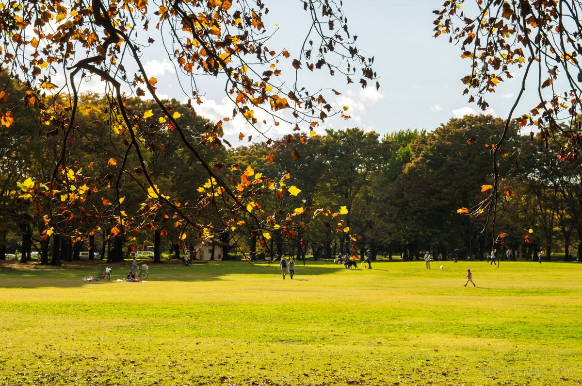
# 13. Girls go hiking

A relatively new phenomenon is the rise of the young female hiker, known colloquially as a Yama girl (mountain girl). Many Yama girls are urban women who enjoy outdoor activities and can be often spotted kitted out in the latest Montbell fashions.
.
Girls go hiking

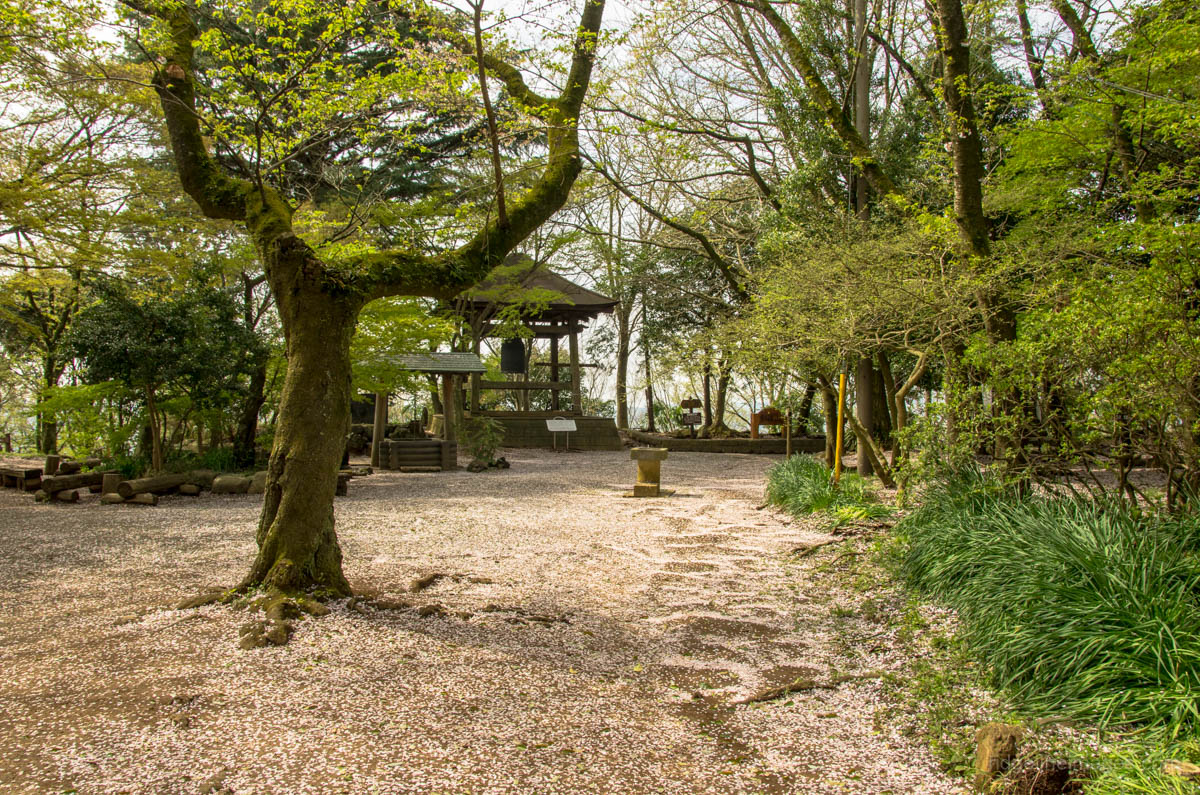
# 14. Leave your itinerary here

Many hiking trails have a tozan posuto box located at the trailhead where you can register your name, date and intentions. While these boxes look like they haven’t been checked in months which is probably the case, they may assist authorities in an emergency.
.
Leave your itinerary here

# 15. Take out mountain insurance

In recent years there have been several well documented cases of foreigners losing their way and to avoid financial ruin in the aftermath consider a comprehensive search and rescue insurance policy. At some popular locations such as Kamikochi, insurance (hoken) can be purchased for 1,000 yen per person per day. For longer term stayers try jRO (Japan Rescue Organization LLC).

# 16. Learn some hiking kanji

Learning kanji doesn’t come easy for most of us so a good option is to specialize in a particular interest. While maps, signs and trail markers occasionally include English translations the vast majority don’t. Eking out a good smattering of hiking kanji won’t go to waste and likely make your life easier especially when relying on your own intuitions.
.
Learn some hiking kanji

# 17. Everyone’s friendly

Day to day small chat isn’t usually a strength of the Japanese however the mountains seem to open people up with plenty of aisatsu (greetings) when passing and hearty cries of encouragement battling up steep climbs. Exchanging contact details after a short conversation is also done a lot more than you would think.

# 18. Pay heed to the weather

As magnificent as the Japanese mountains are, deciding to soldier on in the face of worsening weather is foolhardy at best. Better is to put pride aside and pay heed to the changeable mountain conditions. The same goes during the early winter where the daylight hours quickly fade in the late afternoon. For the latest mountain forecasts checkout mountain-forecast and tenki to kurasu.
.
Pay heed to the weather

# 19. No women allowed

In an era of gender equality it’s incredible that a Japanese mountain remains the sole domain of men. Mount Omine in Nara Prefecture officially prohibits women from climbing its lofty peak on the basis that menstruation and childbirth are linked to Shinto concepts of impurity.

# 20. Phantom trails

The popular Shobunsha Yama-to-Kogen map series does a great job of highlighting the main hiking drags though many more trails aren’t indicated. While some pass through private property others provide short cuts or make a nice diversion away from the masses.

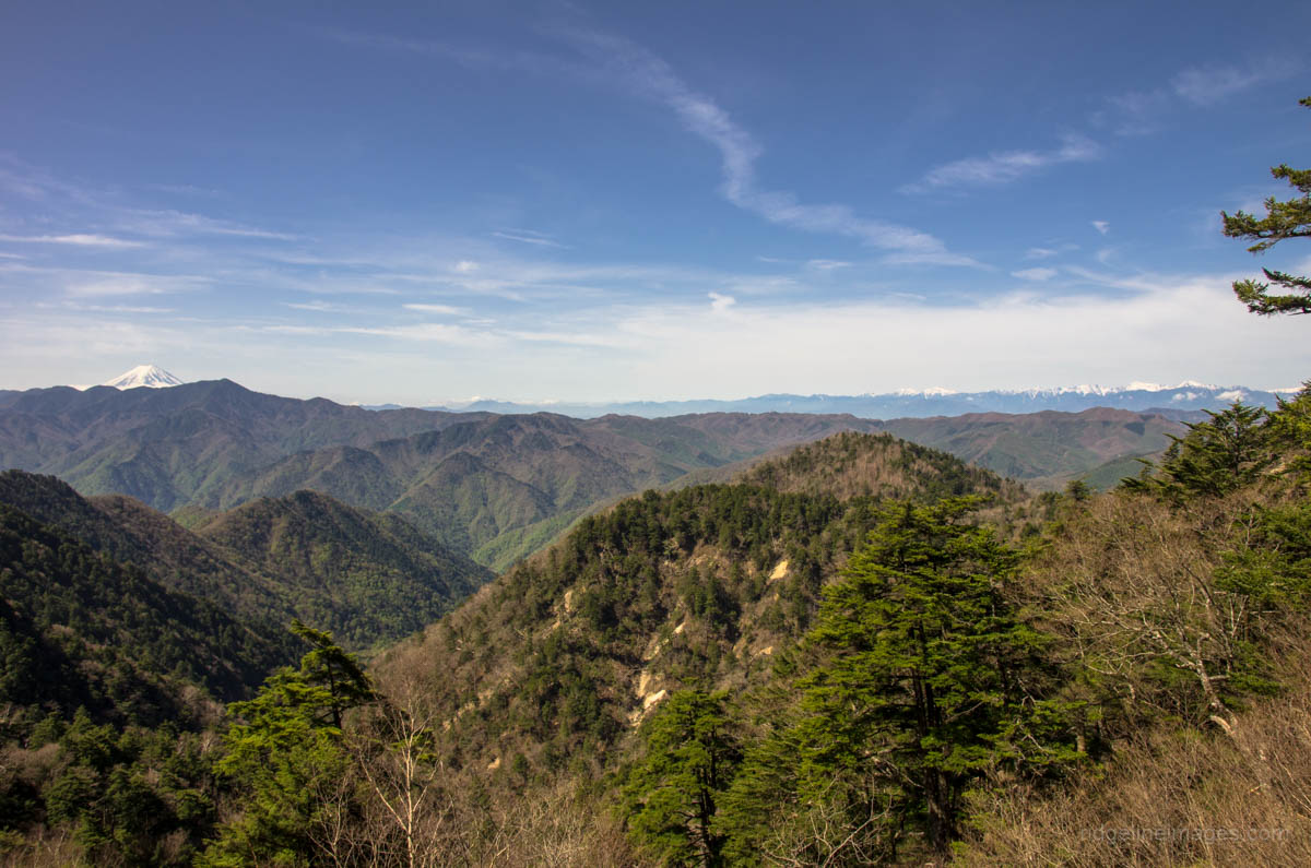
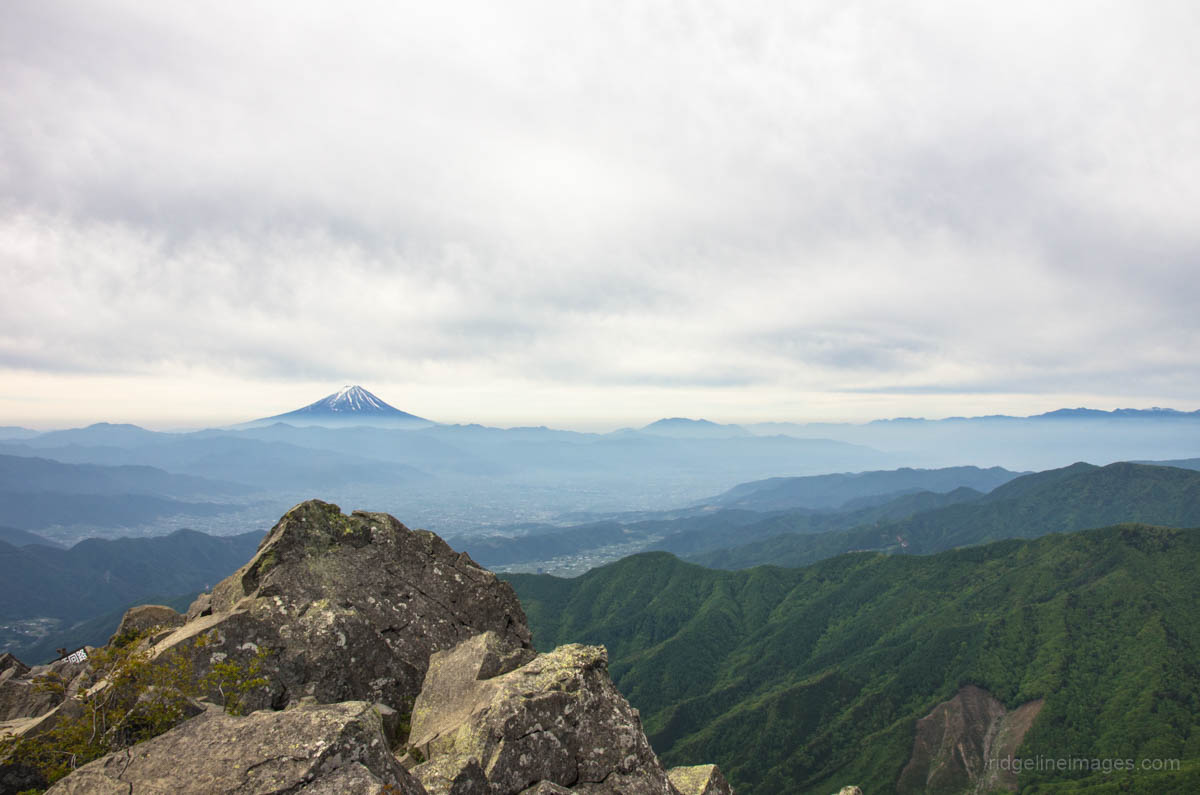
# 21. Stifling hot mountains

Tokyo and in fact most of Japan is unbearably hot during summer and if you think that heading to higher ground might help you’re out of luck. Mountains under the 2,000 meter ceiling can be just as stifling as the city fringes with the combined effects of heat and humidity leaving you wishing you hadn’t bothered.
.
Stifling hot mountains

# 22. Hay fever hell

Like a precision timepiece, Japanese cedar trees (sugi) start releasing their hay fever inducing spores in early February. For those of us unfortunate enough to suffer its effects makes any short excursion outdoor, let alone the mountains, a tale of grim misery.
.
Hay fever hell

# 23. Extensive bus networks

Without access to a world class public transport network which includes bus routes often running close to the trailhead most of the hikes undertaken on this site would be near impossible. Planning for good train / bus connections is advisable as many less travelled destinations may only run one morning bus service.

# 24. Free mountain huts

While most supervised huts will set you back a lazy 6,000 yen ($50 USD) just to rest your head for the night, there are plenty of free ones ranging from antiquated to newly built to save you some coin.
.
Mountain huts

# 25. Invest in a good sleeping bag

If there is one piece of equipment you shouldn’t skimp on it’s a quality sleeping bag. The Japanese made Nanga bag I picked up a couple of years back has been brilliant. Along with weighting in at a feathery 700 grams the 860+ fill power Polish mother goose down pays end to cold nights.

The post 25 Things I’ve Learned Hiking in Japan appeared first on Ridgeline Images.

Hyakuhirono Waterfall

$
0
0
Hyakuhirono Waterfall

Hiking to the Hyakuhirono Waterfall in Okutama

On a dreary overcast day last week I decided to check out a towering waterfall in the Okutama watershed. One of the major drawcards hiking Mount Kawanoriyama is passing by the rather impressive Hyakuhirono Waterfall 百尋の滝. Located in a rather remote corner of Okutama near the Nippara limestone cave the waterfall drops 40 metres in an upstream portion of the Kawakoketani River.

From the Kawanoribashi bus stop walk along the gated Kawanori Forestry Way for 45 minutes to the first rest stop. Recently the hiking trail suffered landslide damage and requires a further 30 minutes of roadside walking from here. Look out for a signpost veering off to the right which heads down to the waterfall.

Negotiating the wooden steps to the waterfall’s plunge pool thankfully has some ropes to grab hold of to steady your footing in the wet. Not surprisingly, I could enjoy the waterfall without the usual hordes of hikers that no doubt congregate in better weather. Wintertime photos show the falls frozen, though they can be accessed and enjoyed anytime of the year.

Access: take a 15 minute bus ride from Okutama Station (bus stop 1) and get off at the Kawanoribashi bus stop (260 yen).
.
Hyakuhirono Waterfall moss rocks Kawakoketani River Hyakuhirono Waterfall Okutama
.


The post Hyakuhirono Waterfall appeared first on Ridgeline Images.

Zamberlan 132 Airound GTX RR Review

$
0
0
Zamberlan 132 Airound GTX RR Review

A New Frontier in Hiking Shoe Design

Zamberlan has a rich history and enjoys excellent reputation when it comes to performance footwear and was eager to road test their latest speed hiking shoes. As someone who prefers the versatility and comfort of a lightweight hiking shoe the Zamberlan 132 Airound GTX RR appeared to tick the right boxes.

The shoes mark a significant advancement in footwear design as they are the first to include 360-degree breathability around the entire foot, a definite blessing when tackling the hot and humid summer conditions in Japan. While the shoes edge on the pricer side of the speed hiking sphere they have shown themselves to be capable of handling a variety of terrain. Zamberlan also offers a mid-cut version of this shoe for those looking for additional ankle support. One point to note is while most Zamberlan footwear is fashioned in Italy these shoes are made in Vietnam.

Comfort/Fit

Out of the box the 132 Airound GTX RR felt terrific and as expected didn’t require any break in time before hitting the trail. Size wise the shoes run about right for a US 9 and feel comfortable wearing standard thickness hiking socks. Coming in at 780 grams a pair they are only marginally heavier than my previous Mammut Redburn GTX’s. The inclusion of an elastic gusset provides decent foot wrapping in the front part of the toe and airflow is maintained using a mesh upper. The other nice aspect is the lack of stitching on the upper which is heat sealed delivering a minimalist, streamlined appearance.

Stability

With any speed hiking shoe stability is paramount and being equipped with a Vibram outsole and thermoplastic polyurethane (TPU) stabilizers under the arch ensures good stability on technical trails. The shoes have a reasonable aggressive stance which differentiates them from most trail running shoes and thus are more suited to long haul overnight backpacking.

Traction

The propriety Zamberlan Vibram speed hiking outsole with V-shaped lugs allow you to confidently scramble up rocky ridges and maintain good traction in the wet. The only issue noted was some underfoot slippage walking downhill along wet bitumen roads.

Protection

The toe protection whilst not as extensive as the Redburn GTX’s still ensures the front foot is adequately shielded from rocks and other trail material. In the wet the shoes have a high degree of waterproofness with PU (polyurethane) sealing in addition to GORE-TEX SURROUND making for a dry, comfortable foot environment.

Final thoughts

Over the past month the shoes have endured some long, hard trails as well as a couple of overnight hikes. The shoes have held up remarkably well and show little in the way of battle scaring. My previous experience with Zamberlan boots are they wear well for the life of the shoe better than most brands and hopefully these will be the same. For those of us who like to push our footwear hard and prefer a lightweight hiking shoe over a traditional hiking boot the 132 Airound GTX RR’s make an appealing choice.

Zamberlan 132 Airound GTX RR key features:

Colour: black

Fabric: air mesh

Weight: men’s size 9 US (Euro 43) 780g (pair)

Lining: GORE-TEX extended comfort + surround

Sole: Zamberlan Vibram speed hiking outsole

Thermoplastic heel and toe

Insole/shank compression molded EVA

Padding open cell foam

Plush tongue and collar

Country of origin: Vietnam

Zamberlan 132 Airound GTX RR Review ($135 USD) (as at Septmber 1, 2015)


Where to buy the Zamberlan 132 Airound GTX RR

Moosejaw | Backcountry

* When you use links above to make your purchase, the seller will contribute a portion of the sale to help support this site.


Zamberlan 132 Airound GTX RR GORE-TEX SURROUND Zamberlan Vibram speed hiking outsole Zamberlan 132 Airound GTX RR up close Wearing the Zamberlan 132 Airound GTX RR

The post Zamberlan 132 Airound GTX RR Review appeared first on Ridgeline Images.

Mt. Ushiokunogangaharasuri 牛奥ノ雁ヶ腹摺山

$
0
0
Mt. Ushiokunogangaharasuri hike

Kurotake 黒岳 – Mt. Koganezawa 小金沢山

Duration: 2 days
Distance: 16.3km
Difficulty: moderate
Usage/Traffic: light
Start: Yamatoten Mokusan Onsen bus stop
Finish: Kamihikawa-toge bus stop
Maps: Shobunsha’s Yama-to-Kogen 山と高原地図 series 1:50,000 [No.24 Mt. Daibosatsu 大菩薩嶺]


.

Wild Camping Affords Majestic Views

This hike was rather reminiscent of last year’s climb to Mt. Okuratakamaru with blue skies intermixed with shrouded mist hampering the view. While the first day’s weather was ordinary to say the least, day two provided a reprieve with a well-defined silhouette of Mount Fuji materialising at dawn.

Day 1: Gloomy Weather and a Heavy Pack (9.3km)

For a description of getting to the trailhead check last year’s trail notes from Mt. Okuratakamaru. The hike follows the same route up to Yunosawatoge 湯ノ沢峠 which takes around 2.5 hours from the Yamatoten Mokusan Onsen bus stop. At Kaiyamato Station there was a hefty throng of hikers waiting for the first morning bus for a short 10 minute commute to the trailhead. As this hike is generally carried out in a reverse direction, more often than not, you will be hiking along the road to Yunosawatoge solo as most passengers get off at Kamihikawa-toge. Below the refuge hut at Yunosawatoge there is a reliable watering hole to fill up your water bottles for wild camping at the gushingly named Mt. Ushiokunogangaharasuri.

From the refuge hut it’s a fairly sustained climb up to Sirayanomaru 白谷丸 (1,920m) where the trail levels out and in good weather Mount Fuji provides a striking backdrop. Time permitting there is a short trail veering off to the right towards a rocky outcrop. From here it should take another 20 minutes to reach Kurotake 黒岳 (1,987m). A little before you reach the summit of Kurotake you pass through an undulating stretch with a few trees displaying early autumn foliage. While the summit doesn’t offer much of a view it makes a pleasant enough spot to take a breather.

The next target is Kawakomozawa 川胡桃沢ノ頭 (1,940m) where a rather forlorn looking sign is revealed in a grassy area. From here the trail slides down to a saddle covered with sasa (bamboo grass). According to the map, there is a “nearby” waterhole about 10 minutes away off to the left. Scouring Yamareco didn’t glean much information and a previous sign post flagging its whereabouts had been torn down – a hum from the watercourse could be heard however. The final push on the opposing ridge passes by some large coniferous trees. On summit of Mt. Ushiokunogangaharasuri 牛奥ノ雁ヶ腹摺山 (1,990m) there is a choice spot to set up a shelter aligning you with Mount Fuji.

Day 2: Enter Clear Skies and Mount Fuji (7km)

The mist and light rain had cleared by sunrise permitting some lazy photos of Mount Fuji outside the tent door. Apart from a few Japanese sika deer making the occasional cry it was a blissful sleep. The tent was as expected completely drenched though the temperature remained comfortable in the low teens during the night. From the campsite the trail continues along the main ridgeline. The first point of call is Mt. Koganezawa 小金沢山 (2,014m) an easy going 45 minute stroll. Take a rest here as from the summit across to Ishimarutoge 石丸峠 the trail demands your full concentration. Keep a careful look out for the pink tape makers and an even more watchful eye on your footwork as you clamber through dense forest and exposed rock gardens.

From Ishimarutoge where the trail opens out in the bamboo grass it remains quite flat apart from a short drop down to a forestry road. At the forestry road turn right and left again after passing by the landslide damaged embankment. Keep alert for the sign post on your left to Kamihikawa-toge 上日川峠 as it’s easy to miss. It takes around 30 minutes to get back to the car park for the 40 minute bus ride to Kaiyamato Station.
.
Trail signs Yunosawatoge Water supplies Sirayanomaru Exposed rocks Sirayanomaru Misty weather Sirayanomaru Early autumn foliage Summit Kurotake Kawakomozawa Campsite Mt. Ushiokunogangaharasuri Mount Fuji from campsite Yatsugatake from campsite Summit Mt. Koganezawa View from Ishimarutoge Looking over Kamihikawa Dam

The post Mt. Ushiokunogangaharasuri 牛奥ノ雁ヶ腹摺山 appeared first on Ridgeline Images.


The Outdoor Guide to Tokyo

$
0
0
The Outdoor Guide to Tokyo

Exploring the Outdoors Around Tokyo

The scale and diversity of Tokyo makes it hard to condense into a short travel write-up, especially the outdoor scene which caters for all and sundry. Having said that, what follows is a brief rundown of some indoor and outdoor activities available in and around Tokyo.

Surprising as it may seem, it’s not overly difficult to escape the neon lights and fast paced living as Tokyo and the wider Kanto region contains many pockets of stunning natural landscapes offering us city dwellers places to recharge. For short term visitors looking to shake off the bustling metropolis, there are plenty of self-guided trails and organized outdoor tours to help you get the most out of your stay.

Outdoor Folks in Tokyo and Beyond

Whether your interests lie in mountaineering, canyoning, rafting, bungy or mountain biking there are plenty of seasoned pros on hand to show you the ropes.
.
Kanto Adventures High alpine extraordinaire David Niehoff offers a wide selection of outdoor adventures tailored according to your skill level and interests.

Canyons Japan Mike Harris brings his experience and know-how with canyoning and rafting tours (Gunma Prefecture).

Bungy Japan Under the skilled tutelage of Charles Odlin, experience Japan’s only bridge bungy jump (Gunma Prefecture).

MTB Japan Mountain biking maverick Nathan Bennett will help you get up to speed in Minakami a hot spring and outdoors sports town (Gunma Prefecture).

Outdoors & Adventure Meetups in Tokyo For some freebies try Outdoors & Adventure Meetups happening near Tokyo.

Hiking in Japan A definitive resource for all things hiking is Wes Lang’s guide to Japan’s day hikes and treks.

Outdoor Destinations

On the outskirts of Tokyo there plenty of excellent day trips waiting to happen. One area not to be missed is Okutama, a sleepy village in the far western reaches. A couple of the better spots in this part of Tokyo include, the Nippara Caves – one of the best karst limestone caves in Japan. There’s also a gentle 9 km hiking trail called the “Mukashi-michi” that stretches from Okutama Station to Lake Okutama trailing the picturesque Tama River. The town also serves as a base for countless nearby hiking trails.

Nagataro

An hour train ride away is the family friendly Mount Takao with numerous paths winding up to a Buddhist temple near the summit. While the place can seem like a madhouse during weekends, it’s a wonderful location to take in Mount Fuji. For more challenging multiday treks visit “Tokyo’s playground” the Chichibu Tama Kai National Park which reaches as far afield as Nagano Prefecture. Several of the mountains here soar above the 2,000 meter ceiling. Neighbouring Saitama Prefecture also has several great locations including Nagatoro with an adjoining gorge playing host to riverboats and rafting adventures.

Rafting adventures Tokyo

Tokyo also has a number of decent sized parks to kick back in. Popular is Showa Memorial Park in Tachikawa around 30 minutes from Shinjuku Station. The 165 hectare park is crisscrossed with cycling trails and hiring a bicycle or tandem is a nice way to spend a leisurely afternoon. Inokashira Park west of the city near the trendy enclave of Kichioji has an interesting weekend art market. For free inner city parks, head to Yoyogi Park next to Meiji Jingu Shrine and Hibiya Park, bordering the Imperial Palace.

Showa Memorial Park

Relaxing in a natural hot spring (onsen) is one of highlights about living here. In the heart of the city Spa Laqua near the Tokyo Dome includes both indoor and outdoor baths. During the summer months there are also plenty of cheap outdoor swimming pools including the Wadabori Outdoor Pool (Nishi-Eifuku Station), Meguro Citizens Center Gymnasium Pool (Meguro Station) and the Aqua Field Pool under the footsteps of the Tokyo Tower. Many rural train stations have nearby hot springs to soak your weary body after a long hike.

Outdoors, Indoors

For indoor escapades a great place to get a bird’s-eye view over Tokyo are the free observation decks atop of the Tokyo Metropolitan Government Building, providing panoramic views of the city and beyond. For a modern architecture fix, Tokyo Midtown in the Roppongi district includes many chic shops and restaurants along with a pleasant Japanese style garden. For better or worse Akihabara or Akiba has become a mecca for not only electronics shops but anime and manga otaku diehards.

In recent years cycling tours in Tokyo have come to the fore, with Tokyo Great Cycling Tour offering sightseers a sampling of the major tourist sites by pedal power. Finally, for a little quirky fun try a Hato Bus Tour with good value tours to most popular locales including English speaking guides.

Hato Bus Tour

Outdoor Shops

Hiking in Japan has really taken off of late, particularly among young urban women known as Yama girls (mountain girls) taking to the trail in their droves. The mountaineering market in Japan is a worth a cool ¥186 billion ($1.5 billion USD) so it’s not surprising Tokyo has a large number of outdoor stores meeting the demand. Some of the better ones are ICI Ishii Sports in Harajuku, Kamoshika in Takadanobaba and Sakaiya in Jimbocho. For equipment rentals a good starting point are any of the ICI Ishii Sports stores which offer a wide selection of gear. A stylish bicycle shop worth dropping by is Crown Gears near Harajuku which is a veritable treasure trove of sports and vintage bicycles.

Kamoshika in Takadanobaba

Sleeping Outdoors

While kanpu jō (campsites) are not overly plentiful in Tokyo, Japan does in fact have several thousand, a few of which will allow you to pitch a tent for free. One of the better ones is the Hikawa kanpu-jō (in Japanese) in Okutama, only 5 minutes from the station. Another good spot is on the eastern side of the Chiba peninsula at Uchiurayama Kenmin no Mori (in Japanese) near Katsuura including 50 campsites and log cabins with nearby hiking trails.

It’s even possible to camp in the 23 wards which make up central Tokyo for ¥600 ($5 USD) per person a night at the Jonanjima Seaside Park campsite in Ota ward and Wakasu-koen Park campsite in Koto ward. Stealth camping while not recommended within the city limits is very doable in rural areas, though watch out for no camping signs, remain discreet and be prepared to move on if requested.

Sleeping outdoors Tokyo

Food & Cafés

With literally thousands of restaurants and hole-in-the-wall watering spots it’s really just a matter of stumbling into whatever takes your fancy. Some personal favorites include Shin Hinomoto, under the tracks at Yurakucho Station run by Englishman Andy Lunt, a great place to get really good Japanese food – advance bookings recommended. One of the better Izakaya or pub chains is Doma-Doma, reasonably priced with English menus. For sushi lovers best bet is to go to the source with plentiful eateries next-door to the Tsukiji fish market – though the market will be relocating in late 2016.

For an opulent dining experience it doesn’t get much better than Ukai which has several branches throughout the city. Ukai Toriyama in Hachioji City is well worth a visit, not only for the delectable grilled beef and manicured gardens but the omotenashi “generous hospitality” close at hand.

If you’re looking for caffeine hit, Tokyo has borne somewhat of a coffee renaissance with several artisanal coffee houses making a mark on the city. For coffee par excellence it’s hard to surpass Paddlers Coffee in Shibuya with resident barista Daisuke Matsushima brewing some of the finest in town. For somewhere a little cosier, Streamer Coffee Company just around the corner churns out fantastic lattes and has comfortable sofas to chill out on. A couple of other shops worth visiting include Aoyama Flower Market Tea House complete with a floral inspired interior (Minato ward) and Viron, one of the better French bakery and brasserie’s in Tokyo (Shibuya).

Ukai Toriyama

Getting Around

As can be expected from a world class public transport system, getting to most areas around Tokyo or Japan for that matter is generally painless. As the JR Pass only covers JR (Japan Railways) trains a good idea is to get yourself either a Suica or Pasmo IC card for non-JR stations or the subway. Most train information boards are in English, however travelling by public bus on the other hand can be confusing as bus destinations are sometimes only written in kanji (Chinese characters).

Hitchhikers in Japan are a rare sight, although some travellers have re-counted tales of success getting to far flung corners not easily accessible by public transport. Similarly, if walking along a rustic stretch of road don’t be surprised to find a Japanese driver pull over and offer you an unexpected lift.

While this guide barely scratches the surface of what the city has to offer, hopefully it provides some inspiration to start planning a trip to Japan. If you have any questions or suggestions about traveling in Tokyo or Japan generally, feel free to leave a comment below.

Getting around Tokyo

Liked this Outdoor Guide to Tokyo, but you’re more likely to visit Stockholm, Helsinki or San Francisco next? Well, you’re in luck! This write-up is part of a collection of city guides compiled at Hiking in Finland. Direct your browser to the Outdoor Guide Directory and check out other outdoor guides from across the globe!

The post The Outdoor Guide to Tokyo appeared first on Ridgeline Images.

Exploring Tokyo by Cable Cars and Ropeways

$
0
0
Exploring Tokyo by Cable Cars and Ropeways

Hitching a Lift up Tokyo’s Mountains

With seventy-two percent of Japan being mountainous it shouldn’t come as a surprise the country contains an extensive network of aerial lifts. In Japan, the term “ropeway” applies to all forms of aerial lift including aerial tramways, funitels, gondola lifts and chairlifts. All told, there are 170 gondolas and aerial tramways whisking day drippers to mountain tops that would be otherwise be difficult to get to. Not to be outdone, Tokyo has several cable cars and ropeways worth exploring on the city’s outer reaches including a couple now relegated to the history books.

Nokogiriyama Ropeway

Nokogiriyama Ropeway Chiba
.
On the Chiba side of Tokyo Bay finds the Nokogiriyama Ropeway. Like many of the ropeways listed here, it was built during the halcyon days of the early 1960s. The upper ropeway station has a fairly austere looking restaurant, gift shop and some telescopes. The observation platform provides some stunning scenery across Tokyo Bay and Mount Fuji in fine weather. Behind the ropeway finds the jagged Sawtooth Mountain and Nihonji Temple complex. Departures every 15 minutes (930 yen round-trip: Weekdays 09:00-17:00).

Opened: 1962  Distance: 680 m (0.4 mi)  Vertical rise: 223 m (732 ft)  Travel time: 4 mins

Oyama Cable Car

Oyama Cable Car Kanagawa
.
The Oyama Cable Car is a funicular cable railway which shuttles passengers up some 278 metres to the sacred Afuri Shrine. Time permitting the 90 minute hike up to Mount Oyama has excellent views in the direction of Oshima Island and the opposing side of Tokyo Bay. Interestingly, the three stations on the line were renamed in 2008 to better reflect local landmarks such as Shimosha Station became Afurijinja Station. Departures every 20 minutes (870 yen round-trip: Weekdays 09:00-16:30 / 17:00 weekends).

Opened: 1931  Distance: 0.8 km (0.5 mi)  Vertical rise: 278 m (912 ft)

Hakone Ropeway

Hakone Ropeway Kanagawa
.
In 2009 the Hakone Ropeway was bestowed the title of the world’s busiest gondola lift with over two million paid passengers. The title has since been relinquished with the ropeway suspending operations in May 2015 due to volcano activity in the Owakudani valley. The ropeway includes four stations with one transfer at Owakudani Station. Spectacular are the views over the blue waters of Lake Ashi and volcanic gases flowing from Owakudani. Departures every 1 minute (2,410 yen round-trip: Daily 08:45-17:15).

Opened: 1960  Distance: 4 km (2.5 mi)  Travel time: 24 mins

Mitake Tozan Cable

Mitake Tozan Cable Tokyo
.
The popular Mitake Tozan Cable has the highest vertical rise of 424 metres saving a good hour of walking time. The cable cars correspond to the arriving buses from Mitake Station. The place becomes a bit of a madhouse during weekends and is best avoided altogether over national holidays. Departures every 15 minutes (1,110 yen round-trip: Daily 07:30-18:30).

Opened: 1927  Distance: 1 km (0.6 mi)  Vertical rise: 424 m (1,390 ft)  Travel time: 5 mins

Takao Chairlift

Takao Chairlift Tokyo
.
A fun and romantic alternative to riding the Takao Tozan Cable is the nearby chairlift which takes a leisurely 12 minutes to ride up Mount Takao. Look out for the danger sign about swinging the lift and refusing intoxicated passengers. Departures every 30 seconds (930 yen round-trip: Daily 09:00-16:30).

Opened: 1959  Travel time: 12 mins

Hodosan Ropeway

Hodosan Ropeway Saitama
.
This little known ropeway in Nagatoro, Saitama holds the distinction of running the oldest aerial lift cabins (55 years old) still used in the Kanto region. Walking through the ropeway terminal building feels akin to walking back in time with much of the infrastructure dating back to its inauguration. Departures every 30 minutes (820 yen round-trip: Daily 09:40-16:30).

Opened: 1961  Distance: 832 m (0.5 mi)  Vertical rise: 236 m (774 ft)  Travel time: 5 mins

Okutama Ropeway

Okutama Ropeway Tokyo
.
During Japan’s high economic growth period in the post war years, there was a flurry of ropeway constructions around Tokyo with some proving more successful than others. The Okutama Ropeway was particularly fateful running for only five short years before being abandoned. A combination of poor positioning along with its relatively short span, doomed it from the outset. Another ropeway which no longer runs is the Mitsumine Ropeway which ferried passenger up to its namesake shrine. Unlike the Okutama Ropeway it at least managed a respectable 43 years of service before ageing facilities and metal fatigue signalled its death knell.

Opened: 1961  Closed: 1966  Distance: 621 m (0.4 mi)  Vertical rise: 0.6 m (2 ft)

The post Exploring Tokyo by Cable Cars and Ropeways appeared first on Ridgeline Images.

Darn Tough Worldwide, Lifetime Guarantee: Put to the Test

$
0
0
Darn Tough Vermont lifetime guarantee

A Company that Stands by their Word

After years of faithful service, quality hiking socks or any socks for that matter tend to wear out. At this point you would normally toss them out or perhaps repurpose them as shoe polishers. That is, unless of course you made the wise decision and invested in a pair from Darn Tough Vermont.

Yes, our life-time guarantee is for Darn Tough Vermont socks no matter where in the world they may be. Our warranty is simple and you can send them the least expensive way to us.

Darn Tough Vermont: customer service

Like many in the outdoor community, I have long extolled the virtues of Darn Tough Vermont. Not only is it a proud family run business that focuses on manufacturing excellence, its products come with a lifetime guarantee, a rare commodity for something which is ostensibly nondurable. The company’s philosophy is simple: wear out a pair of Darn Tough socks and they will replace them, no ifs ands or buts about it. Typically, worn-out pairs can be returned and replaced at, your local outdoor shop where you purchased them, Darn Tough booths at outdoor events or mailed in. This is all very well if you live in continental U.S. but what if suppose you live overseas, in this case Tokyo, Japan and purchased your socks through an online retailer – would the warranty still hold?

Preparing the socks for return shipping

Preparing the socks for return shipping.

In a nutshell, yes it would. After contacting Darn Tough Vermont customer service, I received a quick reply stating the following; “Yes, our life-time guarantee is for Darn Tough Vermont socks no matter where in the world they may be. Our warranty is simple and you can send them the least expensive way to us.” After confirming this brilliant news, it was time to give the socks one final wash and send them on their merry way. It’s worth mentioning the returned items were the lightest of the 6 weights of socks they carry, namely the 1/4 Sock Ultra-Light. Over the years, I have gradually replaced my full sock ensemble with Darn Tough and these pairs are the only ones I’ve ever managed to wear holes in.

The cost of mailing the two pairs via regular airmail along with the Warranty Form, from Tokyo to Vermont was only ¥330 ($2.70 USD). Darn Tough then pays for the return postage with your replacements arriving priority mailed in a padded envelope. For domestic returns, Darn Tough suggests a turnaround time of 15 business days for processing and shipping. Internationally in this case from Tokyo, the total time from first email contact to receiving the replacement socks was around 30 business days. So there you have it, socks which are replaceable, free of charge, for life – what more could you ask for.

Replacements from Darn Tough Vermont

Identical replacement pairs arrive from Darn Tough Vermont.

The post Darn Tough Worldwide, Lifetime Guarantee: Put to the Test appeared first on Ridgeline Images.

Mt. Hodosan 宝登山

$
0
0
Mt. Hodosan hike

Mt. Hodosan 宝登山

Duration: 3 hours
Distance: 4.5km
Difficulty: easy
Usage/Traffic: moderate
Start: Nagatoro Station
Finish: Nagatoro Station
Maps: Shobunsha’s Yama-to-Kogen 山と高原地図 series 1:50,000 [No.24 Okuchichibu 奥武蔵・秩父]


.

Family Friendly Hike in Nagataro, Saitama

Nagatoro along the with Iwadatami Rocks is arguably one the best sightseeing locales in Chichibu, Saitama Prefecture. A relaxing family friendly hike is up nearby Mount Hodosan which is easily accessible from Nagatoro Station along the Chichibu Main Line. From the railway station head west for 700 metres along the road heading up to the Hodosan Jinja. Look for a road veering off to the left next to the restrooms. The Hodosan Ropeway terminal building is located a little above the main car park. The Hodosan Ropeway opened in 1959 and walking through the lower terminal building shows much of the décor and amenities looking like they had escaped the passage of time. The Ropeway runs at 30 minute intervals (820 yen round-trip: Daily 09:40-16:30) and hitching a lift up on clear days provides a picturesque backdrop of the Arakawa River and nearby Mount Buko.

From the upper terminal building it’s a leisurely 10 minute walk to the summit of Mount Hodosan 宝登山 (497m). In late January to mid-February the fragrant yellow flowers of the Robai or wintersweet trees bloom and similarly in autumn it’s a popular place to watch the changing Fall colours. While summit of Mt. Hodosan is hemmed in with tree cover, the upper ropeway station provides good views of the surrounding mountain ranges. When you’re ready to head off, head down the stairs below the upper shrine, turn left and right again before the Small Animal Zoo. The overhead ropeway passes at a couple of points along the access road allowing for some snapshots of the approaching cable cars.
.
Turn left here to the Hodosan Ropeway Hodosan Ropeway lower terminal building Small Animal Zoo Hodosan cable car Hodosan Ropeway upper terminal building Mt. Hodosan Hodosan Ropeway from access road

The post Mt. Hodosan 宝登山 appeared first on Ridgeline Images.

Koganei Park Changing Fall Colours

$
0
0
Autumn Koganei Park

Fall Colours Transform Koganei Park

A nice thing about living in western Tokyo is its expansive planned gardens and parklands. The autumn season is particularly stunning with Showa Park in Tachikawa a major drawcard for locals taking in the changing Fall colours. The last couple of weekends I’ve been roaming Koganei Park, though slightly smaller is a relaxing spot to pull out the picnic rug and while away a lazy afternoon – plus the free entry makes it more enticing than its larger sibling. The park is packed with ubiquitous icho Gingko trees and fiery red maples with plenty of cycling paths and a barbecue area to keep families entertained.
.
Gingko icho trees Relaxing afternoon Koganei Park Maple leaves Trampoline fun Lonesome bike Icho leaves on afternoon sky Kite flying Koganei Park Icho leaves bokeh Fallen icho leaves Approaching dusk
.


The post Koganei Park Changing Fall Colours appeared first on Ridgeline Images.

Viewing all 347 articles
Browse latest View live